Eelderwolde | |
|---|---|
Village | |
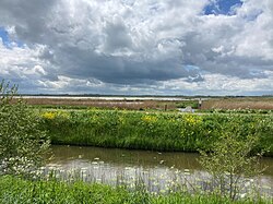 Landscape near Eelderwolde | |
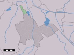 Eelderwolde in the municipality of Tynaarlo. | |
Eelderwolde Location in the province of Drenthe Show map of DrentheEelderwolde Eelderwolde (Netherlands) Show map of Netherlands | |
| Coordinates: 53°11′N 6°33′E / 53.183°N 6.550°E / 53.183; 6.550 | |
| Country | Netherlands |
| Province | Drenthe |
| Municipality | Tynaarlo, Groningen |
| Area | |
• Total | 4.98 km2 (1.92 sq mi) |
| Elevation | 0.0 m (0 ft) |
| Population (2021)1 | |
• Total | 2,970 |
| • Density | 596/km2 (1,540/sq mi) |
| Time zone | UTC+1 (CET) |
| • Summer (DST) | UTC+2 (CEST) |
| Postal code | 97661 |
| Dialing code | 050 |
Eelderwolde is a village in the Dutch province of Drenthe. It is a part of the municipality of Tynaarlo, and lies about 5 km south of Groningen.
History
The village was first mentioned in 1442 as "to Eelderwolde", and means "woods of Eelde".3
Eelderwolde was home to 34 people in 1840. In 1973, a recreation area is developed near Eelderwolde. It was expanded in 1983, and in 1987, a Scandinavian village with sauna was added. Since 2006, the neighbourhood Ter Borch is being developed with will ultimately consists of 1,250 houses.4
References
References
- "Kerncijfers wijken en buurten 2021". Central Bureau of Statistics. Retrieved 11 April 2022.
- "Postcodetool for 9766PA". Actueel Hoogtebestand Nederland (in Dutch). Het Waterschapshuis. Archived from the original on 21 September 2013. Retrieved 11 April 2022.
- "Eelderwolde - (geografische naam)". Etymologiebank (in Dutch). Retrieved 11 April 2022.
- "Eelderwolde". Plaatsengids (in Dutch). Retrieved 11 April 2022.