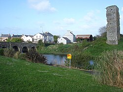
The Doonbeg (Irish: Abhainn an Dúin Bhig)1 is a river of County Clare, western Ireland. Its source is near Kilmaley, and it flows southward for about 7 miles before turning northwestward for about 15 miles and passing Cooraclare before flowing into the sea at Doonbeg.2 At Doonbeg village the N67 road crosses the river on a seven-arched stone bridge. On 20 September 1588, one of the ships of the Spanish Armada, the San Estaban, was wrecked near the mouth of Doonbeg.3
References
References
- "Abhainn an Dúin Bhig/Doonbeg River". logainm.ie. Retrieved 9 December 2023.
- "Doonbeg River". Clare.ie. Archived from the original on 4 March 2016. Retrieved 8 February 2014.
{{cite web}}: CS1 maint: bot: original URL status unknown (link) - Davenport, Fionn (2010). Ireland. Lonely Planet. p. 372. ISBN 978-1-74220-350-8.
52°43′53″N 9°31′25″W / 52.73139°N 9.52361°W / 52.73139; -9.52361