Article · Wikipedia archive · Last revised Jul 31, 2026

Digital raster graphic

A digital raster graphic (DRG) is a digital image resulting from scanning a paper USGS topographic map for use on a computer. DRGs created by USGS are typically scanned at 250 dpi and saved as a TIFF. The raster image usually includes the original border information, referred to as the "map collar". The map file is UTM projected and georeferenced to the surface of the Earth. DRG's are regularly used in GIS applications. DRGs were first produced in 1995.

Last revised
Jul 31, 2026
Read time
≈ 1 min
Length
112 w
Citations
Source
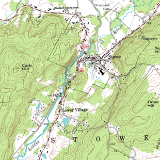
A small portion of a USGS DRG source ↗

A digital raster graphic (DRG) is a digital image resulting from scanning a paper USGS topographic map for use on a computer. DRGs created by USGS are typically scanned at 250 dpi and saved as a TIFF. The raster image usually includes the original border information, referred to as the "map collar". The map file is UTM projected and georeferenced to the surface of the Earth. DRG's are regularly used in GIS applications. DRGs were first produced in 1995.

See also

See also

External links