| Deduru Oya | |
|---|---|
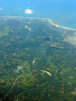 Aerial view of the mouth of Deduru River, Chilaw. | |
| Physical characteristics | |
| Source | |
| • location | Kurunegala District |
| Mouth | |
• location | MAHO |
• coordinates | 07°36′50″N 79°48′12″E / 7.61389°N 79.80333°E / 7.61389; 79.80333 |
• elevation | Sea level |
| Length | 142 km (88 mi) |
Basin size | 2,620 km2 (1,010 sq mi) |
The Deduru Oya (Tamil: மாயவன் ஆறு) is the sixth-longest river of Sri Lanka. The 142 km (88 mi) long river runs across four provinces and five districts.
Tributaries
- Kospothu Oya
- Dik Oya
- Ratwila Ela
- Kimbulwana Oya
- Hakwatuna Oya
- Maguru Oya
- Kolamunu Oya
- Delvita Oya
Its catchment area receives approximately 4,313 million cubic metres of rain per year, and approximately 27 percent of the water reaches the sea. It has a catchment area of 2,620 square kilometres.1