Dawson Bridge | |
|---|---|
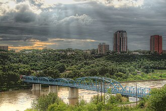 Dawson Bridge in 2013 | |
| Coordinates | 53°32′55.50″N 113°28′1.78″W / 53.5487500°N 113.4671611°W / 53.5487500; -113.4671611 |
| Carries | Motor vehicles, pedestrians |
| Crosses | North Saskatchewan River |
| Locale | Edmonton, Alberta, Canada |
| Official name | Dawson Bridge |
| Characteristics | |
| Total length | 236.5 m (776 feet) |
| Width | 12.5m (41 feet) |
| History | |
| Opened | 1912 |
| Statistics | |
| Daily traffic | 9,456 (2024)1 |
| Location | |
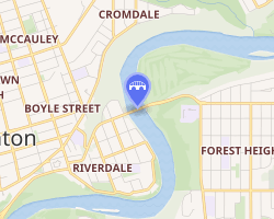 Interactive map of Dawson Bridge | |
The Dawson Bridge is a two lane bridge that spans the North Saskatchewan River in Edmonton, Alberta, Canada.
In early 2010, it underwent repairs, and later reopened on December 20, 2010.2
Dawson Bridge connects the communities of Forest Heights on the east end to Riverdale on the west end.
References
References
- "AAWDT". Google Docs. Retrieved August 8, 2024.
- "Dawson Bridge to reopen Monday". CBC.ca. December 17, 2010. Retrieved January 23, 2011.