| Crasta Mora | |
|---|---|
 | |
| Highest point | |
| Elevation | 2,952 m (9,685 ft) |
| Prominence | 486 m (1,594 ft)1 |
| Parent peak | Piz Calderas |
| Coordinates | 46°34′17″N 9°52′4″E / 46.57139°N 9.86778°E / 46.57139; 9.86778 |
| Geography | |
Crasta Mora Location in Switzerland | |
| Location | Graubünden, Switzerland |
| Parent range | Albula Alps |
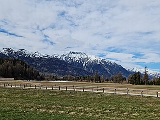
The Crasta Mora is a mountain of the Albula Alps, overlooking Bever in the canton of Graubünden. It lies at the eastern end of the range between the Albula Pass and the Val Bever.
References
References
- Retrieved from the Swisstopo topographic maps. The key col is the Fuorcla Crap Alv (2,466 m).