Corsavy
Cortsaví | |
|---|---|
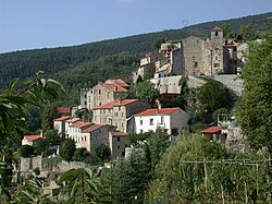 A general view of the village of Corsavy | |
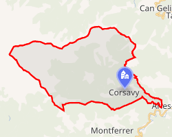 Location of Corsavy | |
Corsavy Corsavy | |
| Coordinates: 42°28′04″N 2°34′47″E / 42.4678°N 2.5797°E / 42.4678; 2.5797 | |
| Country | France |
| Region | Occitania |
| Department | Pyrénées-Orientales |
| Arrondissement | Céret |
| Canton | Le Canigou |
| Intercommunality | Haut Vallespir |
| Government | |
| • Mayor (2020–2026) | Antoine Chrysostome1 |
Area 1 | 47.02 km2 (18.15 sq mi) |
| Population (2023)2 | 246 |
| • Density | 5.23/km2 (13.6/sq mi) |
| Time zone | UTC+01:00 (CET) |
| • Summer (DST) | UTC+02:00 (CEST) |
| INSEE/Postal code | 66060 /66150 |
| Elevation | 345–2,721 m (1,132–8,927 ft) (avg. 800 m or 2,600 ft) |
| 1 French Land Register data, which excludes lakes, ponds, glaciers > 1 km2 (0.386 sq mi or 247 acres) and river estuaries. | |
Corsavy (French pronunciation: [kɔʁsavi] ⓘ; Catalan: Cortsaví) is a commune in the Pyrénées-Orientales department in southern France. It is part of the historical Vallespir comarca. It is renowned for its picturesque mountain landscapes and proximity to Mount Canigó. The village lies at an elevation of approximately 800 meters, with the commune’s altitude ranging from 345 to 2,721 meters.
Geography
Localisation
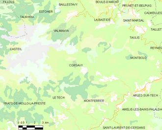
Corsavy is located in the canton of Le Canigou and in the arrondissement of Céret.
Population
| Year | Pop. | ±% p.a. |
|---|---|---|
| 1968 | 282 | — |
| 1975 | 263 | −0.99% |
| 1982 | 190 | −4.54% |
| 1990 | 194 | +0.26% |
| 1999 | 204 | +0.56% |
| 2007 | 201 | −0.19% |
| 2012 | 248 | +4.29% |
| 2017 | 218 | −2.55% |
| 2023 | 246 | +2.03% |
| Source: INSEE3 | ||
References
References
- "Répertoire national des élus: les maires". data.gouv.fr, Plateforme ouverte des données publiques françaises (in French). 2 December 2020.
- "Populations de référence 2023" (in French). National Institute of Statistics and Economic Studies. 18 December 2025.
- Population municipale entre 1968 et 2023, INSEE