| Col de la Cluse | |
|---|---|
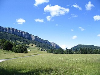 From the Col de la Cluse, view on the Mont Outheran and Col du Mollard | |
Col de la Cluse Location within France | |
| Elevation | 1,169 metres (3,835 ft) |
| Traversed by | D45 |
| Third Approach | |
| Location | Savoie, France |
| Range | Alps |
| Coordinates | 45°27′14″N 5°51′33″E / 45.45389°N 5.85917°E / 45.45389; 5.85917 |
The Col de la Cluse (French pronunciation: [kɔl də la klyz]) is a mountain pass located 1,169 m above sea level in the Chartreuse Mountains.1 It connects Le Désert d'Entremont (commune of Entremont-le-Vieux) to Corbel, Savoie, France. The main road of the pass is the D45.
In winter, It is a departure to the cross country ski slopes. In summer, it is the start of a two-hour hike to access to Roche Veyrand (1,429 m), overlooking Saint-Pierre d'Entremont in Savoie. The nearby Roc de Gleisin can also be reached. It is one of the access roads to the Col du Grapillon, to the east.
References
References
- "Col de la cluse from Corbel". cols-cyclisme.com. Retrieved February 26, 2016.
