Chakia
Bara chakia | |
|---|---|
Town | |
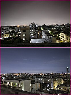 chakia city night view  sugar mill chakia  Gandhi maidan chakia  chakia drone view | |
 Coat of arms | |
| Nickname: Chakia | |
Chakia Location in East Champaran, Bihar, India | |
| Coordinates: 26°25′N 85°03′E / 26.42°N 85.05°E / 26.42; 85.05 | |
| Country |  India India |
| State | Bihar |
| District | East Champaran |
| Ward(s) | 251 |
| Government | |
| • Type | Nagar Parishad2 |
| • Body | Chakia Nagar Parishad |
| Elevation | 52 m (171 ft) |
| Population (2011) | |
• Total | 16,618 |
| • Rank | 4th3 |
| • Density | 3,320/km2 (8,600/sq mi) |
| Demonym | Chakiawasi |
| Languages | |
| • Official | Hindi, Urdu |
| • Regional/Spoken | Bhojpuri |
| Time zone | UTC+5:30 (IST) |
| PIN | 8454124 |
| Telephone code | 06257 |
| ISO 3166 code | IN-BR |
| Vehicle registration | BR05 |
| Lok Sabha constituency | Purvi Champaran |
| Vidhan Sabha constituency | Pipra |
| Website | https://www.e-chakia.com/ |
Chakia is a town in East Champaran district in the Indian state of Bihar. It is located approximately 48 Kilometres northwest of Muzaffarpur. 32 kilometers southeast of Motihari.
Religious
Sita Kund
Sita Kund (Maithili: सीता कुंड) in Chakia is a legendary sacred pond related to the Indian epic Ramayana.5 According to legend, it is believed that during the Treta Yuga, Lord Rama's wedding procession (Ram Baraat) stopped at this place in Motihari and took rest for a night. It is located at outskirts of Chakia town at Vedivan (Bedivan) Madhuban Panchayat in the Chakiya block of the East Champaran district in the Mithila region of the Indian subcontinent. In the ancient, the village was in the Videha Kingdom ruled by King Janaka. It is believed that the princess Sita of Mithila took her bath in this pond during her stay at this village.6789
Transportation
Chakia town is served by road and rail transport. It is located on the Muzaffarpur–Motihari corridor.
- Ram Janki Marg
- NH-27
- NH-227
- NH-227A
- NH-227F
Chakia railway station is on the Muzaffarpur–Gorakhpur main line under the Samastipur railway division.
Demographics
As of 2011 India census,10 Chakia had a population of 16,618. Males constitute 53% of the population and females 47%. Chakia has an average literacy rate of 51%, lower than the national average of 59.5%; with male literacy of 60% and female literacy of 40%. 20% of the population is under 6 years of age.
Blocks
The Chakia Tehsil (subdivision) is divided into 4 Community development block: Chakia/Pipra, Mehsi, Kesariya, Kalyanpur
References
References
- https://www.e-chakia.com/
- "चकिया नगर पंचायत". District Administration, East Champaran, Government of Bihar (in Hindi). National Informatics Centre. Retrieved 19 June 2026.
- "Villages & Towns in Chakia(Pipra) Block, Purbi Champaran, Bihar". Census2011.co.in. Retrieved 20 June 2026.
- "Chakia Pin Code: Chakia, Purbi Champaran, Bihar". www.pincodeinfo.online. Retrieved 21 December 2022.
- "सीता कुंड का है पौराणिक महत्व". www.livehindustan.com (in Hindi). 25 September 2025. Retrieved 6 January 2026.
- "सीताकुंड धाम में कैफेटेरिया निर्माण की खुदाई में मिला शिवलिंग:त्रेता युग में मोतिहारी के इस जगह पर रुकी थी प्रभु श्रीराम की बारात". Dainik Bhaskar.
- "इस जगह रूकी थी भगवान राम की बारात, अब यहां उगता है ऐसा फल, जिसमें खिचड़ी का आता है स्वाद". News 18.
- "सीता कुंड धाम में खुदाई के दौरान मिला प्राचीन शिवलिंग, पूजा-अर्चना के लिए उमड़ी भक्तों की भीड़ - ancient shivling found during excavation at sita kund dham". Jagran (in Hindi). Retrieved 6 January 2026.
- "पूर्वी चंपारण : प्रसिद्ध सीताकुंड धाम का होगा सौंदर्यीकरण,वन विभाग लगाएगा सैकड़ों सीता अशोक के पौधे - The famous Sitakund Dham of East Champaran will be beautified and the Forest Department will plant hundreds of Sita Ashoka plants". Jagran (in Hindi). Retrieved 6 January 2026.
- "Census of India 2011: Data from the 2011 Census, including cities, villages and towns (Provisional)". Archived from the original on 16 June 2004.