Castlecliff | |
|---|---|
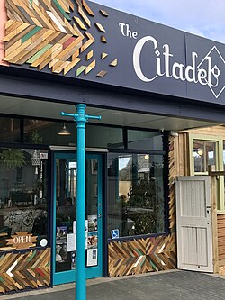 A café in Castlecliff | |
 Interactive map of Castlecliff | |
| Coordinates: 39°56′35″S 174°59′37″E / 39.943031°S 174.993740°E / -39.943031; 174.993740 | |
| Country | New Zealand |
| City | Whanganui |
| Local authority | Whanganui District Council |
| Area | |
| • Land | 865 ha (2,140 acres) |
| Population (June 2025)1 | |
• Total | 4,260 |
| • Density | 492/km2 (1,280/sq mi) |
| Kai Iwi | Westmere | Tawhero |
|
|
Gonville | |
| (South Taranaki Bight) | (Whanganui River mouth) |
Castlecliff is a suburb of Whanganui, in the Whanganui District and Manawatū-Whanganui region of New Zealand's North Island. The name was given by the Harbour Board, on the suggestion of the future Prime Minister, John Ballance,3 when it established the township on what were described as "barren sandhills" in 1882. Many of the streets were named after Harbour Board members.4 The northern harbour breakwater extended 900 ft (270 m) by 1885.5 The freezing works was built in 1891.6
Demographics
Castlecliff covers 8.65 km2 (3.34 sq mi)2 and had an estimated population of 4,260 as of June 2025,1 with a population density of 492 people per km2.
| Year | Pop. | ±% p.a. |
|---|---|---|
| 2006 | 3,420 | — |
| 2013 | 3,264 | −0.66% |
| 2018 | 3,714 | +2.62% |
| 2023 | 4,026 | +1.63% |
| Source: 78 | ||
Castlecliff had a population of 4,026 in the 2023 New Zealand census, an increase of 312 people (8.4%) since the 2018 census, and an increase of 762 people (23.3%) since the 2013 census. There were 2,094 males, 1,920 females, and 12 people of other genders in 1,479 dwellings.9 3.7% of people identified as LGBTIQ+. There were 858 people (21.3%) aged under 15 years, 792 (19.7%) aged 15 to 29, 1,719 (42.7%) aged 30 to 64, and 657 (16.3%) aged 65 or older.7
People could identify as more than one ethnicity. The results were 70.6% European (Pākehā); 43.0% Māori; 6.3% Pasifika; 3.4% Asian; 0.4% Middle Eastern, Latin American and African New Zealanders (MELAA); and 2.5% other, which includes people giving their ethnicity as "New Zealander". English was spoken by 96.3%, Māori by 12.5%, Samoan by 0.8%, and other languages by 5.1%. No language could be spoken by 2.5% (e.g. too young to talk). New Zealand Sign Language was known by 1.1%. The percentage of people born overseas was 10.5, compared with 28.8% nationally.7
Religious affiliations were 23.9% Christian, 0.6% Hindu, 0.1% Islam, 6.3% Māori religious beliefs, 0.7% Buddhist, 0.9% New Age, and 1.3% other religions. People who answered that they had no religion were 58.0%, and 8.9% of people did not answer the census question.7
Of those at least 15 years old, 387 (12.2%) people had a bachelor's or higher degree, 1,845 (58.2%) had a post-high school certificate or diploma, and 942 (29.7%) people exclusively held high school qualifications. 111 people (3.5%) earned over $100,000 compared to 12.1% nationally. The employment status of those at least 15 was 1,350 (42.6%) full-time, 423 (13.4%) part-time, and 162 (5.1%) unemployed.7
| Name | Area (km2) |
Population | Density (per km2) |
Dwellings | Median age | Median income |
|---|---|---|---|---|---|---|
| Castlecliff West | 3.02 | 1,776 | 587 | 699 | 40.3 years | $30,80010 |
| Castlecliff East | 2.81 | 2,109 | 751 | 729 | 34.4 years | $33,30011 |
| Balgownie | 2.82 | 141 | 50 | 51 | 35.4 years | $27,90012 |
| New Zealand | 38.1 years | $41,500 |
Education
Castlecliff School is a state primary school for Year 1 to 6 students,1314 with a roll of 142.15 It opened in 1892.16
Aranui School is another state primary school for Year 1 to 6 students,17 with a roll of 57.18 It opened in 1965.19
Te Kura o Kokohuia is a Year 1 to 8 state primary school,20 with a roll of 227.21 It was the first bilingual school in Whanganui. It was in existence in 1991.22
Te Kura Kaupapa Māori o Tupoho is a Māori language immersion primary school for Year 1 to 8 students,23 with a roll of 170.24 It started in 1996 as a satellite school of Te Kura o Kokohuia.25
All these schools are co-educational. Rolls are as of March 2026.26
References
References
- "Subnational population estimates - Aotearoa Data Explorer". Statistics New Zealand. Retrieved 29 October 2025.
- "Stats NZ Geographic Data Service". Statistical Area 2 2023 (generalised). Retrieved 17 November 2025.
- "HARBOUR BOARD Wanganui Herald". paperspast.natlib.govt.nz. 8 November 1882. Retrieved 30 June 2023.
- "LOCAL AND GENERAL. Wanganui Chronicle". paperspast.natlib.govt.nz. 8 November 1882. Retrieved 30 June 2023.
- "A TRIP TO THE HEADS BY RAIL. Wanganui Herald". paperspast.natlib.govt.nz. 27 April 1885. Retrieved 30 June 2023.
- "THE WANGANUI FREEZING WORKS Wanganui Chronicle". paperspast.natlib.govt.nz. 10 June 1891. Retrieved 30 June 2023.
- "Totals by topic for individuals, (RC, TALB, UR, SA3, SA2, Ward, Health), 2013, 2018, and 2023 Censuses". Stats NZ – Tatauranga Aotearoa – Aotearoa Data Explorer. Castlecliff West (223600), Castlecliff East (223800) and Balgownie (224700). Retrieved 3 October 2024.
- "Statistical area 1 dataset for 2018 Census". Statistics New Zealand. March 2020. Castlecliff West (223600), Castlecliff East (223800) and Balgownie (224700).
- "Totals by topic for dwellings, (RC, TALB, UR, SA3, SA2, Ward, Health), 2013, 2018, and 2023 Censuses". Stats NZ – Tatauranga Aotearoa – Aotearoa Data Explorer. Retrieved 3 October 2024.
- "Totals by topic for individuals, (RC, TALB, UR, SA3, SA2, Ward, Health), 2013, 2018, and 2023 Censuses". Stats NZ - Tatauranga Aotearoa - Aotearoa Data Explorer. Castlecliff West. Retrieved 3 October 2024.
- "Totals by topic for individuals, (RC, TALB, UR, SA3, SA2, Ward, Health), 2013, 2018, and 2023 Censuses". Stats NZ - Tatauranga Aotearoa - Aotearoa Data Explorer. Castlecliff East. Retrieved 3 October 2024.
- "Totals by topic for individuals, (RC, TALB, UR, SA3, SA2, Ward, Health), 2013, 2018, and 2023 Censuses". Stats NZ - Tatauranga Aotearoa - Aotearoa Data Explorer. Balgownie. Retrieved 3 October 2024.
- "Castlecliff School Official School Website". castlecliff.school.nz.
- "Castlecliff School Ministry of Education School Profile". educationcounts.govt.nz. Ministry of Education.
- "Castlecliff School Education Review Office Report". ero.govt.nz. Education Review Office.
- Brooks, Paul (5 April 2017). "Castlecliff chalks up 125 years". Whanganui Chronicle.
- "Aranui School Ministry of Education School Profile". educationcounts.govt.nz. Ministry of Education.
- "Aranui School Education Review Office Report". ero.govt.nz. Education Review Office.
- Brooks, Paul (1 July 2015). "School looks back on 50 years". Whanganui Chronicle.
- "Kokohuia School Ministry of Education School Profile". educationcounts.govt.nz. Ministry of Education.
- "Kokohuia School Education Review Office Report". ero.govt.nz. Education Review Office. Retrieved 17 November 2025.
- Tumuaki, Charles Oliver (November 1991). "Kokohuia : a school on the move".
- "Te Kura Kaupapa Māori o TupohoMinistry of Education School Profile". educationcounts.govt.nz. Ministry of Education.
- "Te Kura Kaupapa Māori o TupohoEducation Review Office Report". ero.govt.nz. Education Review Office.
- Wylie, Liz (10 December 2020). "Haere ra: Long-serving trio bid farewell to beloved Whanganui kura". Whanganui Chronicle.
- "New Zealand Schools Directory". New Zealand Ministry of Education. Retrieved 1 March 2026.