Callaghan, Texas | |
|---|---|
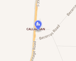 Interactive map of Callaghan, Texas | |
| Coordinates: 27°52′28″N 99°23′54″W / 27.87444°N 99.39833°W / 27.87444; -99.39833 | |
| Country | United States |
| State | Texas |
| County | Webb |
| Established | 1881 |
| Area | |
• Total | 0.85 sq mi (2.2 km2) |
| • Land | 0.85 sq mi (2.2 km2) |
| • Water | 0 sq mi (0.0 km2) |
| Elevation | 610 ft (190 m) |
| Population (1990) | |
• Total | <100 |
| Time zone | UTC-6 (CST) |
| • Summer (DST) | UTC-5 (CST) |
| Zip Code | 78045 |
| Area code | +1-956 |
| GNIS feature ID | 13780851 |
| Nearest Airports: Laredo: Laredo International Airport (KLRD) (LRD) Nuevo Laredo: Quetzalcoatl International Airport (MMNL) (NLD) | |
Callaghan is a ranching community in Webb County, Texas, United States which was established in 1881. The community was named after a nearby ranch owned by Charles Callaghan, and much later, Joe B. Finley. The community was once a cattle shipping point on the International and Great Northern Railroad.2 Callaghan is served by the Callaghan Ranch Airport (ICAO: 90TX). Callaghan is fourteen miles north of Laredo.
Geography
Callaghan is located at 27°52′28″N 99°23′54″W / 27.87444°N 99.39833°W / 27.87444; -99.39833 (27.879444, -99.396667).
Education
Callaghan is served by the United Independent School District in Laredo.