| Caichinque | |
|---|---|
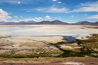 The volcanic complex is in the mid-distance. The snow-patched mountain looming over Caichinque is Pular. | |
| Highest point | |
| Elevation | 4,450 m (14,600 ft) |
| Coordinates | 23°57′0″S 67°44′0″W / 23.95000°S 67.73333°W / -23.95000; -67.73333 |
| Geography | |
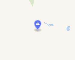 | |
| Location | Chile |
| Parent range | Andes |
| Geology | |
| Stratovolcanoes | |
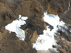
Caichinque is a volcanic complex lying between Salar de Talar and Salar de Capur, in the high Andean plateau of the Antofagasta Region, in Chile. It is located southwest of the Salar de Atacama, directly S of Cerro Miñiques and SE of Cordón Puntas Negras forming part of the main branch of the Andean volcanic chain in this area. Route CH-23 is an approach road to the volcano area and could be impacted by eruptions.1
The volcano has erupted rocks with composition ranging from basalt to dacite. It grew atop a rhyodacitic ignimbrite.1
References
References
- Amigo, Álvaro R.; Bertin, Daniel U.; Orozco, Gabriel L. (2012). Peligros volcánicos de la Zona Norte de Chile (PDF) (Report). Carta geológica de Chile: Serie Geología Ambiental (in Spanish). Vol. 17. SERVICIO NACIONAL DE GEOLOGÍA Y MINERÍA. p. 20. ISSN 0717-7305. Archived from the original (PDF) on June 29, 2021. Retrieved 20 August 2021.
- "Caichinque". Global Volcanism Program. Smithsonian Institution.
- González-Ferrán, Oscar (1995). Volcanes de Chile. Santiago, Chile: Instituto Geográfico Militar. p. 640 pp. ISBN 956-202-054-1.(Spanish)