| Cactus Range | |
|---|---|
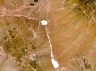 The range is the green/brown area in the southwest part of the image. The Tonopah Test Range Airport lies on the northwest flank of the range. | |
| Highest point | |
| Peak | Antelope Peak |
| Elevation | 2,300 m (7,500 ft) |
| Coordinates | 37°37.59′N 116°45.35′W / 37.62650°N 116.75583°W / 37.62650; -116.75583 |
| Geography | |
Country | United States |
State | Nevada |
District | Nye County |
Range coordinates | 37°40′53.776″N 116°49′33.233″W / 37.68160444°N 116.82589806°W / 37.68160444; -116.82589806 |
| Topo map | USGS Cactus Spring |
The Cactus Range is a small mountain range in Nye County, Nevada.1 The range lies southwest of Cactus Flat and north of Pahute Mesa. Goldfield lies 23 mi (37 km) to the west in Esmeralda County. The range lies within the restricted area of the Tonopah Test Range.
Named peaks in the range include:2
- Antelope Peak 7,500 ft (2,300 m) at 37°37.59′N 116°45.35′W / 37.62650°N 116.75583°W / 37.62650; -116.75583
- Cactus Peak 7,477 ft (2,279 m) at 37°46.97′N 116°52.69′W / 37.78283°N 116.87817°W / 37.78283; -116.87817
- Urania Peak 7,333 ft (2,235 m) at 37°41.98′N 116°50.10′W / 37.69967°N 116.83500°W / 37.69967; -116.83500
- Mount Helen 7,120 ft (2,170 m) at 37°30.39′N 116°44.46′W / 37.50650°N 116.74100°W / 37.50650; -116.74100
Cactus Range was so named on account of cacti in the area.3
References
References
- "Cactus Range". Geographic Names Information System. United States Geological Survey, United States Department of the Interior. Retrieved May 4, 2009.
- Cactus Flat, Nevada 1:100,000 scale topographic map, 37116-EM-TM-100, USGS, 1988
- Federal Writers' Project (1941). Origin of Place Names: Nevada (PDF). W.P.A. p. 55.