Buor-Sysy
Буор-Сысы Буор Сыһыы (Sakha) | |
|---|---|
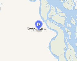 Interactive map of Buor-Sysy | |
Buor-Sysy Location of Buor-Sysy Show map of RussiaBuor-Sysy Buor-Sysy (Sakha Republic) Show map of Sakha Republic | |
| Coordinates: 66°29′06″N 143°03′08″E / 66.48500°N 143.05222°E / 66.48500; 143.05222 | |
| Country | Russia |
| Federal subject | Sakha Republic1 |
| Administrative district | Momsky District1 |
| Rural okrugSelsoviet | Indigirsky National Rural Okrug1 |
| Elevation | 190 m (620 ft) |
| Population | |
• Total | 387 |
• Estimate (2021) | 352 (−9%) |
| • Capital of | Indigirsky National Rural Okrug1 |
| • Municipal district | Momsky Municipal District3 |
| • Rural settlement | Indigirsky National Rural Settlement3 |
| • Capital of | Indigirsky National Rural Settlement3 |
| Time zone | UTC+11 (MSK+8  4) 4) |
| Postal code5 | 678871 |
| OKTMO ID | 98633414101 |
Buor-Sysy (Russian: Буор-Сысы; Yakut: Буор Сыһыы, Buor Sıhıı) is a rural locality (a selo), the only inhabited locality, and the administrative center of Indigirsky National Rural Okrug of Momsky District in the Sakha Republic, Russia, located 10 kilometers (6.2 mi) from Khonuu, the administrative center of the district. Its population as of the 2010 Census was 387,2 of whom 198 were male and 189 female, down from 463 recorded during the 2002 Census.1
References
References
Notes
- Registry of the Administrative-Territorial Divisions of the Sakha Republic
- Sakha Republic Territorial Branch of the Federal State Statistics Service. Results of the 2010 All-Russian Census. Численность населения по районам, городским и сельским населённым пунктам Archived March 4, 2016, at the Wayback Machine (Population Counts by Districts, Urban and Rural Inhabited Localities) (in Russian)
- Law #173-Z 353-III
- "Об исчислении времени". Официальный интернет-портал правовой информации (in Russian). June 3, 2011. Retrieved January 19, 2019.
- Почта России. Информационно-вычислительный центр ОАСУ РПО. (Russian Post). Поиск объектов почтовой связи (Postal Objects Search) (in Russian)
Sources
- Official website of the Sakha Republic. Registry of the Administrative-Territorial Divisions of the Sakha Republic. Momsky District. (in Russian)
- Государственное Собрание (Ил Тумэн) Республики Саха (Якутия). Закон №173-З №353-III от 30 ноября 2004 г. «Об установлении границ и о наделении статусом городского и сельского поселений муниципальных образований Республики Саха (Якутия)», в ред. Закона №1058-З №1007-IV от 25 апреля 2012 г. «О внесении изменений в Закон Республики Саха (Якутия) "Об установлении границ и о наделении статусом городского и сельского поселений муниципальных образований Республики Саха (Якутия)"». Вступил в силу со дня официального опубликования. Опубликован: "Якутия", №245, 31 декабря 2004 г. (State Assembly (Il Tumen) of the Sakha (Yakutia) Republic. Law #173-Z No. 353-III of November 30, 2004 On Establishing the Borders and on Granting the Urban and Rural Settlement Status to the Municipal Formations of the Sakha (Yakutia) Republic, as amended by the Law #1058-Z No. 1007-IV of April 25, 2012 On Amending the Law of the Sakha (Yakutia) Republic "On Establishing the Borders and on Granting the Urban and Rural Settlement Status to the Municipal Formations of the Sakha (Yakutia) Republic". Effective as of the day of the official publication.).