| Boythorpe | |
|---|---|
Boythorpe Location within Derbyshire | |
| OS grid reference | SK376702 |
| District | |
| Shire county | |
| Region | |
| Country | England |
| Sovereign state | United Kingdom |
| Post town | CHESTERFIELD |
| Postcode district | S40 |
| Dialling code | 01246 |
| Police | Derbyshire |
| Fire | Derbyshire |
| Ambulance | East Midlands |
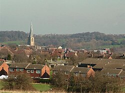
Boythorpe is a small suburb to the south-west of Chesterfield town centre in Derbyshire, England.1 2 It also borders Birdholme to its east, and Walton to its west. The area mainly consists of social housing, although Chesterfield's cricket ground is within the largest park, Queen's Park, which is located in Boythorpe on the edge of the town centre. Boythorpe has a large secondary school, Parkside Community School, which serves students aged 11–16, located on the district's main thoroughfare, Hunloke Avenue.
References
References
- Ordnance Survey: Landranger map sheet 119 Buxton & Matlock (Chesterfield, Bakewell & Dove Dale) (Map). Ordnance Survey. 2012. ISBN 9780319231890.
- "Ordnance Survey: 1:50,000 Scale Gazetteer" (csv (download)). www.ordnancesurvey.co.uk. Ordnance Survey. 1 January 2016. Retrieved 30 January 2016.