Bilot Sharif | |
|---|---|
Town and union council | |
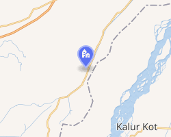 Interactive map of Bilot Sharif | |
| Country | Pakistan |
| Region | Khyber Pakhtunkhwa |
| District | Paharpur District |
| Time zone | UTC+5 (PST) |
Bilot Sharif or Bilot is a town and union council of Paharpur District in Khyber Pakhtunkhwa province of Pakistan.1 It is located at 32°15′20″N 71°9′41″E and has an altitude of 180 metres (593 feet).2
Bilot is a popular tourist destination of a pre-Islamic era, about 55 km from the Dera Ismail Khan city on Chashma road. The ruins are situated on a hill and are easily viewable from main road. Bilot is also famous for a Sufi shrine, which is why it is called "Bilot Sharif".