Bestensee | |
|---|---|
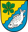 Coat of arms | |
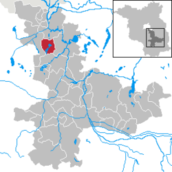
Location of Bestensee
within Dahme-Spreewald district | |
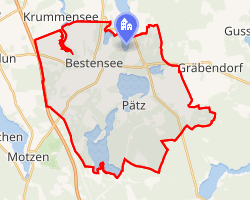 Location of Bestensee | |
Bestensee Bestensee | |
| Coordinates: 52°15′N 13°39′E / 52.250°N 13.650°E / 52.250; 13.650 | |
| Country | Germany |
| State | Brandenburg |
| District | Dahme-Spreewald |
| Subdivisions | 3 Ortsteile |
| Government | |
| • Mayor (2023–31) | Roland Holm1 (Ind.) |
| Area | |
• Total | 38.04 km2 (14.69 sq mi) |
| Elevation | 36 m (118 ft) |
| Population (2024-12-31)2 | |
• Total | 9,171 |
| • Density | 241.1/km2 (624.4/sq mi) |
| Time zone | UTC+01:00 (CET) |
| • Summer (DST) | UTC+02:00 (CEST) |
| Postal codes | 15741 |
| Dialling codes | 033763 |
| Vehicle registration | LDS |
| Website | www.bestensee.de |
Bestensee (German pronunciation: [ˈbɛstn̩zeː] ⓘ) is a municipality in the district of Dahme-Spreewald in Brandenburg in Germany.
Demography
-
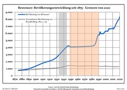 Development of Population since 1875 within the Current Boundaries (Blue Line: Population; Dotted Line: Comparison to Population Development of Brandenburg state; Grey Background: Time of Nazi rule; Red Background: Time of Communist rule)
 -
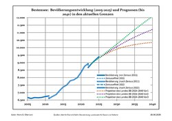 Recent Population Development and Projections (Population Development before Census 2011 (blue line); Recent Population Development according to the Census in Germany in 2011 and 2022 (blue bordered line); Official projection for 2024-2040 in three variants (dotted lines 2025-2040)
Bestensee: Population development within the current boundaries (2025)3 | |||||||||||||||||||||||||||||||||||||||||||||||||||||||||||||||||||
|
| ||||||||||||||||||||||||||||||||||||||||||||||||||||||||||||||||||
References
References
- Landkreis Dahme-Spreewald Wahl der Bürgermeisterin / des Bürgermeisters. Retrieved 25 June 2024.
- "Bevölkerungsstand im Land Brandenburg Dezember 2024 (Fortgeschriebene amtliche Einwohnerzahlen, basierend auf dem Zensus 2023)" (XLS). Amt für Statistik Berlin-Brandenburg (in German).
- Detailed data sources are to be found in the Wikimedia Commons.Population Projection Brandenburg at Wikimedia Commons