| Beiarelva | |
|---|---|
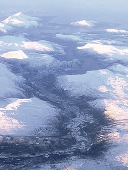 The Beiarelva as seen from the air in the Beiar Valley | |
 | |
| Location | |
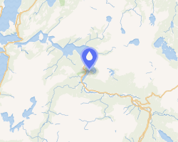
| Country | Norway |
| County | Nordland |
| Municipality | Beiarn Municipality |
| Physical characteristics | |
| Source | Svartisen |
| • location | Nordland, Norway |
| • coordinates | 66°40′59″N 14°25′14″E / 66.68310°N 14.42059°E / 66.68310; 14.42059 |
| • elevation | 900 metres (3,000 ft) |
| Mouth | Beiar Fjord |
• location | Beiarn Municipality, Norway |
• coordinates | 67°02′03″N 14°35′04″E / 67.03420°N 14.58452°E / 67.03420; 14.58452 |
• elevation | 0 metres (0 ft) |
| Length | 54 km (34 mi) |
Basin size | 1,052 km2 (406 sq mi) |
The Beiarelva is a river in Beiarn Municipality in Nordland, Norway. The river begins at the Svartisen glacier high in the mountains near the municipal borders of Beiarn Municipality, Meløy Municipality, and Rana Municipality inside the Saltfjellet-Svartisen National Park. The river then flows north and then west through the Beiar Valley to the head of Beiar Fjord. It has a length of about 54 kilometers (34 mi) and a drainage area of 1,052 square kilometers (406 sq mi), and is among the largest rivers in Nordland county.12
References
References
- Lauritzen, Per Roger, ed. (2009). "Beiarelva". Norsk Fjelleksikon (in Norwegian). Arendal: Friluftsforlaget. ISBN 978-82-91-49547-7.
- Godal, Anne Marit (ed.). "Beiarelva". Store norske leksikon (in Norwegian). Oslo: Norsk nettleksikon. Retrieved 26 October 2013.