| Beiar Valley | |
|---|---|
| Beiardalen (Norwegian) | |
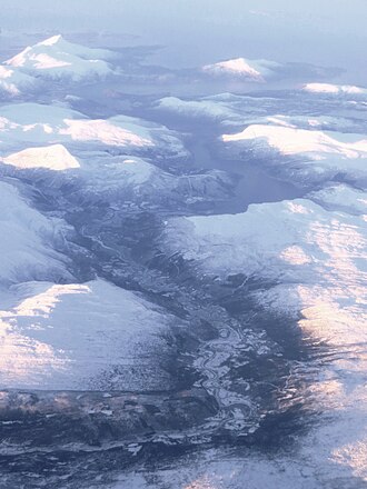 Aerial photo of an east-west view of the Beiar Valley, with Beiar Fjord at the top | |
| Length | 60 kilometres (37 mi) |
| Geology | |
| Type | River valley |
| Geography | |
| Location | Nordland, Norway |
Population centers | Moldjord |
| Coordinates | 66°43′53″N 14°31′23″E / 66.73126°N 14.52302°E / 66.73126; 14.52302 |
| Rivers | Beiar River |
| Location | |
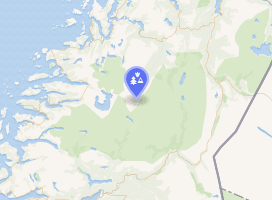 Interactive map of the valley | |
The Beiar Valley1 (Norwegian: Beiardalen) is a valley in Beiarn Municipality in Nordland, Norway. It is about 60 kilometers (37 mi) long.2 Most of the residents of the municipality of Beiarn live in this valley.
The highest parts of the southern end of the valley are located within Saltfjellet–Svartisen National Park. The Beiar River flows through the valley before emptying into the Beiar Fjord at the north end of the valley.34
References
References
- Hallström, Gustaf. 1938. Monumental Art of Northern Europe from the Stone Age. I. The Norwegian Localities. Stockholm: Thule, p. 133.
- Venseth, Tove Bragstad. 2016. Vår vakre region. Bodø i Vinden (March 31).
- Lauritzen, Per Roger, ed. (2009). "Beiardalen". Norsk Fjelleksikon (in Norwegian). Arendal: Friluftsforlaget. ISBN 978-82-91-49547-7.
- Godal, Anne Marit (ed.). "Beiardalen". Store norske leksikon (in Norwegian). Oslo: Norsk nettleksikon. Retrieved 26 October 2013.