Beaumetz | |
|---|---|
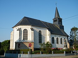 The church in Beaumetz | |
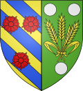 Coat of arms | |
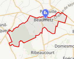 Location of Beaumetz | |
Beaumetz Beaumetz | |
| Coordinates: 50°08′30″N 2°07′19″E / 50.1417°N 2.1219°E / 50.1417; 2.1219 | |
| Country | France |
| Region | Hauts-de-France |
| Department | Somme |
| Arrondissement | Amiens |
| Canton | Doullens |
| Intercommunality | CC Territoire Nord Picardie |
| Government | |
| • Mayor (2020–2026) | Jean-Michel Magnier1 |
Area 1 | 6.16 km2 (2.38 sq mi) |
| Population (2023)2 | 215 |
| • Density | 34.9/km2 (90.4/sq mi) |
| Time zone | UTC+01:00 (CET) |
| • Summer (DST) | UTC+02:00 (CEST) |
| INSEE/Postal code | 80068 /80370 |
| Elevation | 93–144 m (305–472 ft) (avg. 142 m or 466 ft) |
| 1 French Land Register data, which excludes lakes, ponds, glaciers > 1 km2 (0.386 sq mi or 247 acres) and river estuaries. | |
Beaumetz (Picard: Bieumé) is a commune in the Somme department in Hauts-de-France in northern France.
Geography
Beaumetz is situated at the junction of the D185 and D925 roads, some 20 miles (32 km) east of Abbeville. It is surrounded by the communes Ribeaucourt, Prouville and Domesmont.
Population
| Year | Pop. | ±% p.a. |
|---|---|---|
| 1968 | 198 | — |
| 1975 | 191 | −0.51% |
| 1982 | 167 | −1.90% |
| 1990 | 157 | −0.77% |
| 1999 | 170 | +0.89% |
| 2007 | 199 | +1.99% |
| 2012 | 230 | +2.94% |
| 2017 | 226 | −0.35% |
| 2023 | 215 | −0.83% |
| Source: INSEE3 | ||
References
References
- "Répertoire national des élus: les maires" (in French). data.gouv.fr, Plateforme ouverte des données publiques françaises. 13 September 2022.
- "Populations de référence 2023" (in French). National Institute of Statistics and Economic Studies. 18 December 2025.
- Population municipale entre 1968 et 2023, INSEE