| Babor Range | |
|---|---|
| جبل البابور / Idurar n Ibabuṛen | |
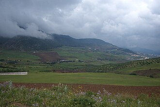 View of the Babor Range near Bougaa | |
| Highest point | |
| Peak | Mount Babor |
| Elevation | 2,004 m (6,575 ft) |
| Coordinates | 36°33′0″N 5°28′0″E / 36.55000°N 5.46667°E / 36.55000; 5.466671 |
| Geography | |
Babor Range | |
| Parent range | Tell Atlas |
The Babor Range (Arabic: جبل البابور; Kabyle: Idurar n Ibabuṛen) is a mountain range of the Tell Atlas in Algeria. The highest point of the range is 2,004 m high Mount Babor.2
The Babor Range, together with the neighboring Bibans, is part of the mountainous natural region of Petite Kabylie.3
Ecology
There is a protected area in the range, the Djebel Babor Nature Reserve, known for birdwatching.4 It is also one of the few remaining habitats for the endangered Barbary macaque, Macaca sylvanus.5
Features
-
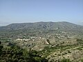 View of Mansoura, Bordj Bou Arreridj Province
 -
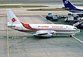 The Air Algerie Boeing 737-2T4/Adv named "Monts des Babors"
References
References
- Google Earth
- Chaîne des Babors - Larousse.fr
- Encyclopédie berbère - Kabylie : Géographie
- African Birding Resources, 2008
- C. Michael Hogan, 2008
External links
External links
- African Birding Resources (2008) Algeria: Hotspots
- C. Michael Hogan, (2008) Barbary Macaque: Macaca sylvanus, Globaltwitcher.com, ed. N. Strõmberg