| Argut | |
|---|---|
 | |
 | |
| Location | |
| Country | Russia |
| Physical characteristics | |
| Mouth | Katun |
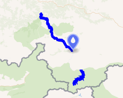
• coordinates | 50°14′20″N 86°40′34″E / 50.23889°N 86.67611°E / 50.23889; 86.67611 |
| Length | 232 km (144 mi) |
Basin size | 9,550 km2 (3,690 sq mi) |
| Basin features | |
| Progression | Ob→ Kara Sea |
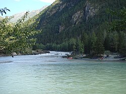
The Argut (Russian: Аргут; Altay: Аркыт, romanized: Arqıt) is a river in central Altai Republic, a right tributary of Katun. Upstream from its confluence with the Dzhazator, it is called Akalakha.
Geography
The Argut is 232 kilometres (144 mi) long (including Akalakha), and has a drainage basin of 9,550 square kilometres (3,690 sq mi).1 Due to the abundance of glaciers 40% of the runoff is yielded glaciers and permanent snow (in particular, from the northern slope of the Tavan Bogd massif), 34% - seasonal snow 17% - rain, 9% - by groundwater. The river is frozen from November until April.
References
References
- "Река Аргут (Ак-Алаха) in the State Water Register of Russia". textual.ru (in Russian).