| Antiesen | |
|---|---|
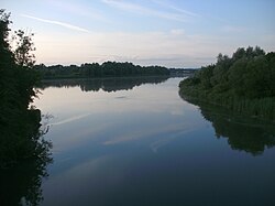 The Antiesen discharging into the Inn | |
Location of mouth in Austria | |
| Location | |
| Country | Austria |
| State | Upper Austria |
| Physical characteristics | |
| Mouth | |
• location | Inn |
• coordinates | 48°22′15″N 13°24′30″E / 48.3707°N 13.4084°E / 48.3707; 13.4084 |
| Length | 44.7 km (27.8 mi) 1 |
| Basin features | |
| Progression |
Inn→ Danube→ Black Sea |
The Antiesen is a river of Upper Austria and a right tributary of the Inn.2 It is 44.7 km (27.8 mi) long. It flows into the Inn near Antiesenhofen.2
References
References
- DORIS Atlas (Upper Austria)
- "Antiesen mouth" (Map). Google Maps. Retrieved 23 February 2020.