| Altmann | |
|---|---|
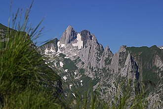 The east side | |
| Highest point | |
| Elevation | 2,435 m (7,989 ft) |
| Prominence | 313 m (1,027 ft)1 |
| Parent peak | Säntis |
| Coordinates | 47°14′22.4″N 9°22′18.4″E / 47.239556°N 9.371778°E / 47.239556; 9.371778 |
| Geography | |
Altmann Location in Switzerland Show map of SwitzerlandAltmann Location in the canton of Appenzell Innerrhoden Show map of Canton of Appenzell InnerrhodenAltmann Location in the canton of St. Gallen Show map of Canton of St. Gallen | |
| Location | Appenzell Innerrhoden/St. Gallen |
Country | Switzerland |
| Parent range | Appenzell Alps |
The Altmann is a mountain in the Appenzell Alps, located on the border between the cantons of Appenzell Innerrhoden and St. Gallen, Switzerland. It is part of the Alpstein massif, situated north of Wildhaus (St. Gallen) and a few kilometres from the Säntis.
The Altmann is a steep limestone tower, which rises about 1,000 metres (3,300 ft) over the valleys of the Alpstein. The normal route to Altmann starts at Rotstein Pass (Rotsteinpass) at 2,120 metres (6,960 ft) on the north-west side and is considered an easy climb.
See also
See also
References
References
- Retrieved from the Swisstopo topographic maps. The key col is the Rotsteinpass (2,122 m)