| Alte River | |
|---|---|
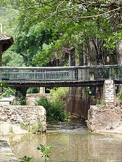 Alte river within the village of Alte | |
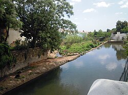
Confluence of the Alte River and the Quarteira River | |
| Location | |
| Country | Portugal |
| Region | Algarve |
| District | Faro |
| Municipality | Loulé |
| Physical characteristics | |
| Source | |
| • location | Alte, Algarve |
| • coordinates | 37°14′17.7″N 8°09′57.6″W / 37.238250°N 8.166000°W / 37.238250; -8.166000 |
| Source confluence | |
| • location | Quarteira River |
| • coordinates | 37°10′51.5″N 8°12′28.1″W / 37.180972°N 8.207806°W / 37.180972; -8.207806 |
| • elevation | 50 m (160 ft) |
| Mouth | Into the Atlantic Ocean at Quarteira |
| Length | 7.2 mi (11.6 km), North East to South West |
The Alte River (Portuguese pronunciation: [ˈaltɨ]) is a small river in the Portuguese region of the Algarve.1 The river along with the Algibre River, another tributary, becomes the Quarteira River after the two rivers conflux. The source2 of the river is a short distance east of the village of Alte and it runs for a distance of 11.6 kilometres (7.2 mi) to its confluence with the Algibre River near the village of Paderne.
Description
The Algibre is one of a number of small rivers in the central Algarve which make up the water ecosystem known as the Querença–Silves Aquifer System.3
Gallery
-
-
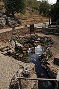 The source of the river close to the village of Alte
 -
 Bridge over the river within the village of Alte
 -

-

-

References
References
- The Algarve. Rough guides – Penguin Group. 2010. ISBN 9781848364981.
{{cite book}}:|work=ignored (help) - Tours around the Algarve. Algarve Tourism Board/ Rotas © Região de Turismo do Algarve. 2008. p. 50.
{{cite book}}:|work=ignored (help) - "Quantifying and modelling the contribution of streams that recharge the Querença – Silves Aquifer in south Portugal" (PDF). Information about the Aquifer System. Natural Hazards and Earth System Sciences.