| Ala-Archa | |
|---|---|
 | |
 | |
| Native name | Ала-Арча (Kyrgyz) |
| Location | |
| Country | Kyrgyzstan |
| Region | Chüy Region |
| District | Alamüdün District |
| City | Bishkek |
| Physical characteristics | |
| Mouth | Chu |
• coordinates | 43°03′44″N 74°38′18″E / 43.0623°N 74.6382°E / 43.0623; 74.6382 |
| Length | 78 km (48 mi) |
Basin size | 270 km2 (100 sq mi) |
| Basin features | |
| Progression | Chu→ Betpak-Dala desert |
| Tributaries | |
| • right | Kashka-Suu |
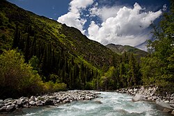
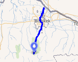
The Ala-Archa (Kyrgyz: Ала-Арча, also Аларча) is a river flowing through Alamüdün District of Chüy Region of Kyrgyzstan. It rises on the northern slopes of Kyrgyz Ala-Too and flows north to enter the river Chu in Chüy Valley. The Ala-Archa is 78 kilometres (48 mi) long and has a basin area of 270 square kilometres (100 mi2).1 Its water comes mostly from glaciers and snow.2
Course
The river runs through Ala Archa National Park and through Bishkek. Other settlements in the river basin are Kashka-Suu, Baytik, Orto-Say, Tash-Döbö and Mayevka.
References
References
- "Аларча" [Alarcha] (PDF). Кыргызстандын Географиясы [Geography of Kyrgyzstan] (in Kyrgyz). Bishkek. 2004. p. 181.
{{cite encyclopedia}}: CS1 maint: location missing publisher (link) - Чүй облусу:Энциклопедия [Encyclopedia of Chüy Oblast] (in Kyrgyz and Russian). Bishkek: Chief Editorial Board of Kyrgyz Encyclopedia. 1994. p. 718. ISBN 5-89750-083-5.