Aghin
Աղին | |
|---|---|
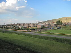 Aghin | |
Aghin Aghin | |
| Coordinates: 40°35′24″N 43°41′54″E / 40.59000°N 43.69833°E / 40.59000; 43.69833 | |
| Country | Armenia |
| Province | Shirak |
| Municipality | Ani |
| Elevation | 1,479 m (4,852 ft) |
| Population (2011) | |
• Total | 3821 |
| Time zone | UTC+4 |
| • Summer (DST) | UTC+5 |
| Aghin at GEOnet Names Server | |
Aghin (Armenian: Աղին) is a village in the Ani Municipality of the Shirak Province of Armenia, near the border of Turkey
Demographics
The Statistical Committee of Armenia reported that the community's population was 598 in 2010,2 up from 547 at the 2001 census.3 The village of Aghin's population was 474 at the 2001 census.3
| Year | Pop. | ±% p.a. |
|---|---|---|
| 1897 | 1,004 | — |
| 1926 | 443 | −2.78% |
| 1939 | 771 | +4.35% |
| 1959 | 612 | −1.15% |
| 1970 | 791 | +2.36% |
| 1979 | 359 | −8.40% |
| 2001 | 474 | +1.27% |
| 2011 | 382 | −2.13% |
 | ||
| Source: 4 | ||
References
References
- "Shirak (Armenia): Towns and Villages in Municipalities". www.citypopulation.de. Retrieved 2024-11-22.
- "Marzes of Armenia and Yerevan City in Figures, 2010" (PDF). Statistical Committee of Armenia.
- Report of the results of the 2001 Armenian Census, Statistical Committee of Armenia
- Հայաստանի Հանրապետության բնակավայրերի բառարան [Republic of Armenia settlements dictionary] (PDF) (in Armenian). Yerevan: Cadastre Committee of the Republic of Armenia. 2008. Archived from the original (PDF) on 11 March 2018.